Orbit-to-ground infrastructure

Know where every beam can land.

Plan orbital delivery, evaluate ground capacity, and coordinate the network from one operating picture.

Simulated product view
This product screenshot uses simulated mock data.BeamDesk constellation view showing orbital paths and scheduled transfers between spacecraft and receivers.
One connected system

From orbital intent to usable ground.

BeamDesk is the operating and market infrastructure between an orbital network and the ground that receives it. Each layer carries context into the next.

Layer 01

Operate the network

Turn geometry and operating limits into a network schedule that can be inspected and revised.

  • Scheduling
  • Transfers
  • Constraints
  • Disruption recovery
Layer 02

Calculate the ground

Resolve where delivery is useful, what a station can see, and which candidate ground fits.

  • Stations
  • Access windows
  • Candidate parcels
  • Explainable scoring
Layer 03

Coordinate the market

Carry operator requirements into ground matching and a machine-accessible coordination layer.

  • Operator requirements
  • Ground matching
  • Approaches
  • API access
Product walkthrough · simulated network

Follow the operating picture from orbit to parcel.

Four linked views expose how a schedule becomes a ground decision. Every product image in this sequence shows simulated mock data.

Stage 01

See the constellation and every scheduled transfer.

Bring orbital geometry, access windows, transfers, and operating constraints into one network view. The demonstration shows how a scheduler can make the path from supplier to receiver inspectable.

Simulated product view
This product screenshot uses simulated mock data.BeamDesk constellation view showing orbital paths and scheduled transfers between spacecraft and receivers.
8
Active transfers in view
Simulated
335
Scheduled transfers
Next 24 hours
Simulated
92/100
Optimization score
Simulated
Stage 02

Resolve the sky above each ground station.

Move from the network schedule to a station-specific sky plot. BeamDesk relates the next window, delivery aperture, track, and following opportunities without requiring screenshot text to carry the explanation.

Simulated product view
This product screenshot uses simulated mock data.BeamDesk ground-station coverage view with the next delivery window, a polar sky plot, and a time ribbon.
72.3°
Peak elevation
Simulated
95%
Aperture in the displayed window
Simulated
0.7 min
Displayed window duration
Simulated
Stage 03

Translate a beam into ground footprint and power context.

Relate an illustrated beam envelope to the receiving site, then keep rated power beside modeled average delivery. Site scale, duty, and assumptions remain visible instead of collapsing into a single headline figure.

Simulated product view
This product screenshot uses simulated mock data.BeamDesk site view relating a modeled receiving footprint to scale and delivered-power context.
2.7 km
Displayed site width
Simulated
95 MW
Rated at full beam
Only while overhead
Simulated
21 MW
Modeled average in the demonstration
Estimated
Stage 04

Rank candidate ground against the requirement.

Screen orbit-relevant regions, compare candidate parcels, and preserve the reasons behind a rank. The map and portfolio shown here use the console’s deterministic demonstration dataset.

Simulated product view
This product screenshot uses simulated mock data.BeamDesk candidate-parcel map showing orbit-aware ground regions and ranked simulated sites.
18
Parcels screened
Simulated
14/18
Clearing aperture
Simulated
395k ac
Qualified acreage shown
Simulated
Simulated product view
This product screenshot uses simulated mock data.BeamDesk constellation view showing orbital paths and scheduled transfers between spacecraft and receivers.
For satellite operators

Your orbits determine where to build.

BeamDesk derives useful ground regions from orbital geometry, resolves station access, and ranks candidate capacity against the operator’s stated requirement.

Geometry before geography

Start with the constellation, then narrow the ground.

Use sky coverage to see when a ground location and an orbit align. Carry those modeled opportunities into a ground search without presenting a candidate region as guaranteed capacity.

The screenshots are simulated product views. A live result depends on the operator’s current element set, stated requirement, and available supporting records.
Simulated sky view
This product screenshot uses simulated mock data.Expanded polar sky plot showing modeled spacecraft tracks, the delivery aperture, and station geometry.
BeamGround · Ground network

Match today’s hosting needs while planning the receiving sites ahead.

BeamGround extends the operating picture into ground-capacity evaluation. Its two site types address different infrastructure horizons and should not be treated as equally mature offerings.

Gateway Host

Near-term commercial ground hosting: evaluate sites for gateway equipment, connectivity, access, and an operator’s present requirements.

Rectenna Site

Longer-term infrastructure planning: preserve candidate ground and assumptions for receiving systems that are not represented here as deployed commercial capacity.

Candidate-site visuals are simulated. Ranking is decision support, not a statement of regulatory approval, owner commitment, or construction readiness.
Simulated ground-capacity view
This product screenshot uses simulated mock data.BeamDesk candidate-parcel map showing orbit-aware ground regions and ranked simulated sites.
Evidence and provenance

Every consequential number carries its source.

BeamDesk separates observation, supporting records, modeling, and unresolved constraints so a decision-maker can see what a number means before relying on it.

Measured

Measured

Observed or computed information stays attached to its method, source, and relevant epoch.

Documented

Documented

A public or access-controlled record remains connected to the claim it supports.

Estimated

Estimated

Modeled results and assumptions are presented as estimates, never silently promoted to facts.

Provisional

Provisional or constrained

Hatched treatment identifies incomplete inputs, open constraints, or information not yet offered for reliance.

Seen for real

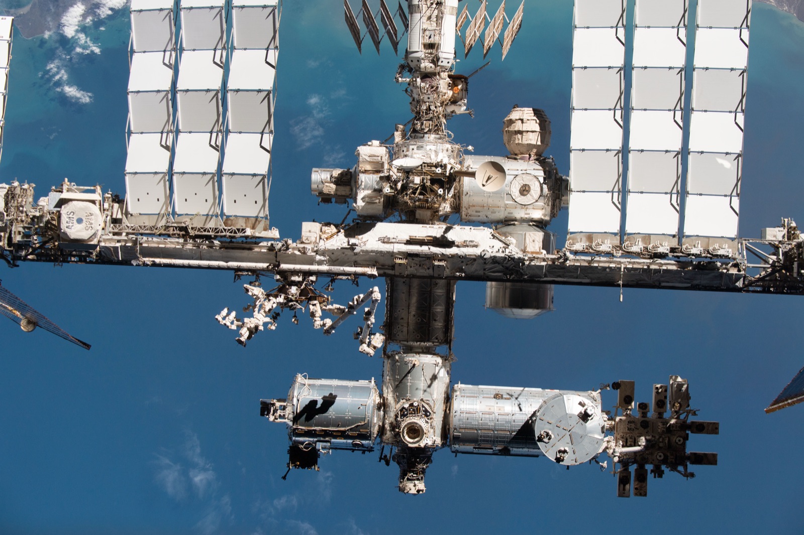
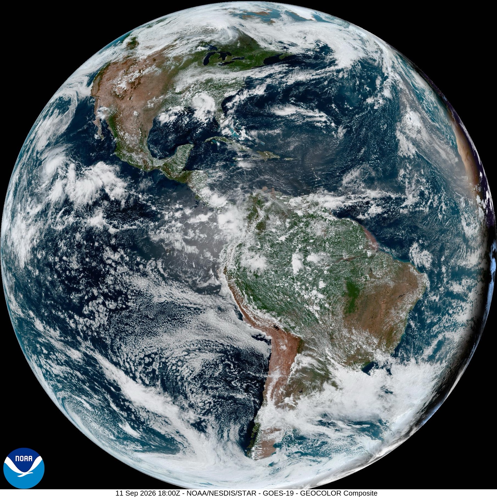
The spacecraft are real, and people photograph them.

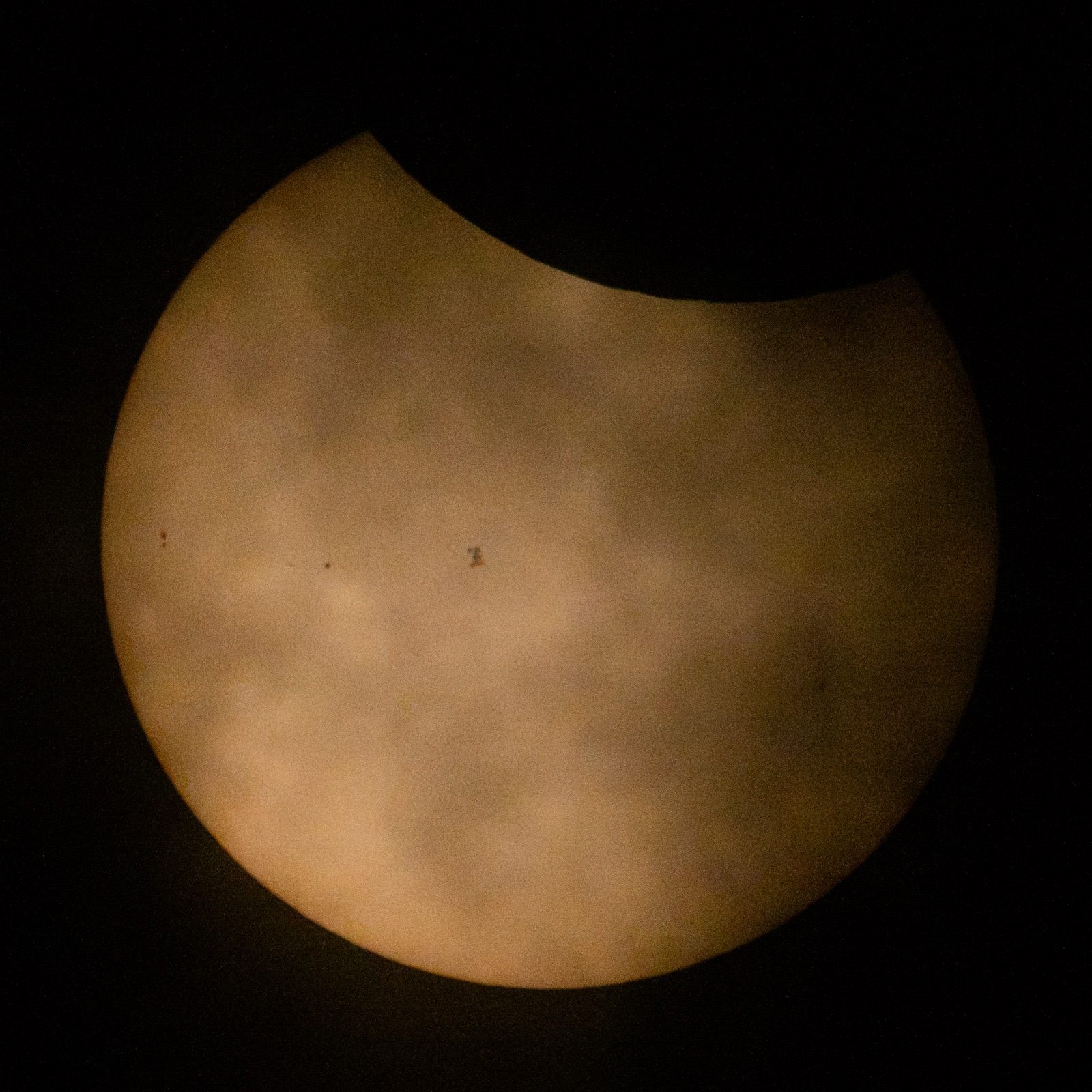
Every product view on this page is simulated. These three are not: public-domain photographs of the Space Station from the ground and from orbit, and the Earth from geostationary orbit, each with its credit and licence.

Who photographs satellites

Telescopes, cameras and feeds, with the licence on every image

From a rooftop in Tel Aviv to a 1 m telescope on Tenerife to an imager on another satellite, the pointing problem a power link starts from is being solved in public. The sky page collects who does it, what they use, and what may be reused.

Hosted only where the licence allows. Linked everywhere else. No embedded player anywhere on this site.

The International Space Station as a small dark silhouette on the face of the Sun, with the Moon covering the upper edge, photographed from the ground on 12 August 2026.
The Space Station crossing the Sun on 12 August 2026, with the Moon already taking a bite from the top. Partial from where the camera stood; a transit lasts under a second, and the pointing and timing are the whole photograph.
Credit: NASA/Joel KowskyNASA, public domainTaken 2026-08-12SourceRetrieved 2026-09-12
Developers

Carry the ground picture into your own systems.

Use API-key-authenticated machine routes for coverage, listings, and the standards registry. BeamDesk also exposes draft BPI capability and opportunity messages; BPI is BeamDesk-authored, remains a draft, and should not be read as an adopted industry standard.

Read-only machine interface

Coverage is one request away.

The static request uses the documented coverage route and its required bearer authentication. Fleet-dependent coverage can return an unavailable response when no current real fleet is installed.

  • Coverage API
  • Listings API
  • Standards registry
  • Draft BPI messages
  • API-key machine authentication
Coverage API requestHTTPS · JSON
curl --request GET \
  --url 'https://api.beamdesk.space/api/public/v1/coverage?lat=32.1&lon=34.8' \
  --header 'Authorization: Bearer $BEAMDESK_API_KEY'
Coordinate the next layer

Build the ground picture before the network needs it.

Connect orbital planning, ground evaluation, and market coordination in one operating infrastructure layer.

BeamDesk — Know where every beam can land